Southward Skies

Yesterday I began to illustrate the story of my two weeks volunteering on an archaeological project in Gwaii Haanas. See my post Around Charlotte for an introduction to the project and a send off on today’s journey. On the way south from Charlotte the crew split into two rides – one was a very fast and brand new landing craft chartered to get the gear and some people to our destination which left directly from the government dock in Charlotte for a 200km one way trip.
I went on the second ride which involves taking a truck over the ferry to Moresby Island and from there driving on logging roads to Moresby Camp, the end of the road to the south. From there we picked up a Parks Canada boat, the Storm Petrel, launched it and headed about 165km south through mostly protected waterways.
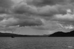
I should back up and say our day started off perfectly – an old friend of the project and former crew member invited us to his home in Skidegate for breakfast. We are talking 6 am – that is some friend. The sky and water were brightly lit across from his house and I stopped to take the picture above, not guessing that the sky would become the theme of the day’s journey across water.
One of the things about taking the ferry and then driving to Moresby Camp is it is a kind of threshold that feels like a passage towards wilderness. On this trip, the feeling came sooner than usual when a Peregrine Falcon swooped from the sky and came to rest on a branch beside the road in front of the truck. I did not get a great shot as my focus was not perfect, but good enough to show here since when will I ever get another photograph of one?

The bridge was under repair along the road so we had to park the truck and carry our gear across a temporary foot bridge to another truck placed on the other side of the bridge a few days earlier for our use. With various delays picking up the boat from a nearby fish hatchery and launching it at Moresby Camp it was some time before we got on the water. The shot below is taken from the dock. Moresby Camp was at one time a major logging camp but is now the end of the road sporting only a boat ramp and dock.

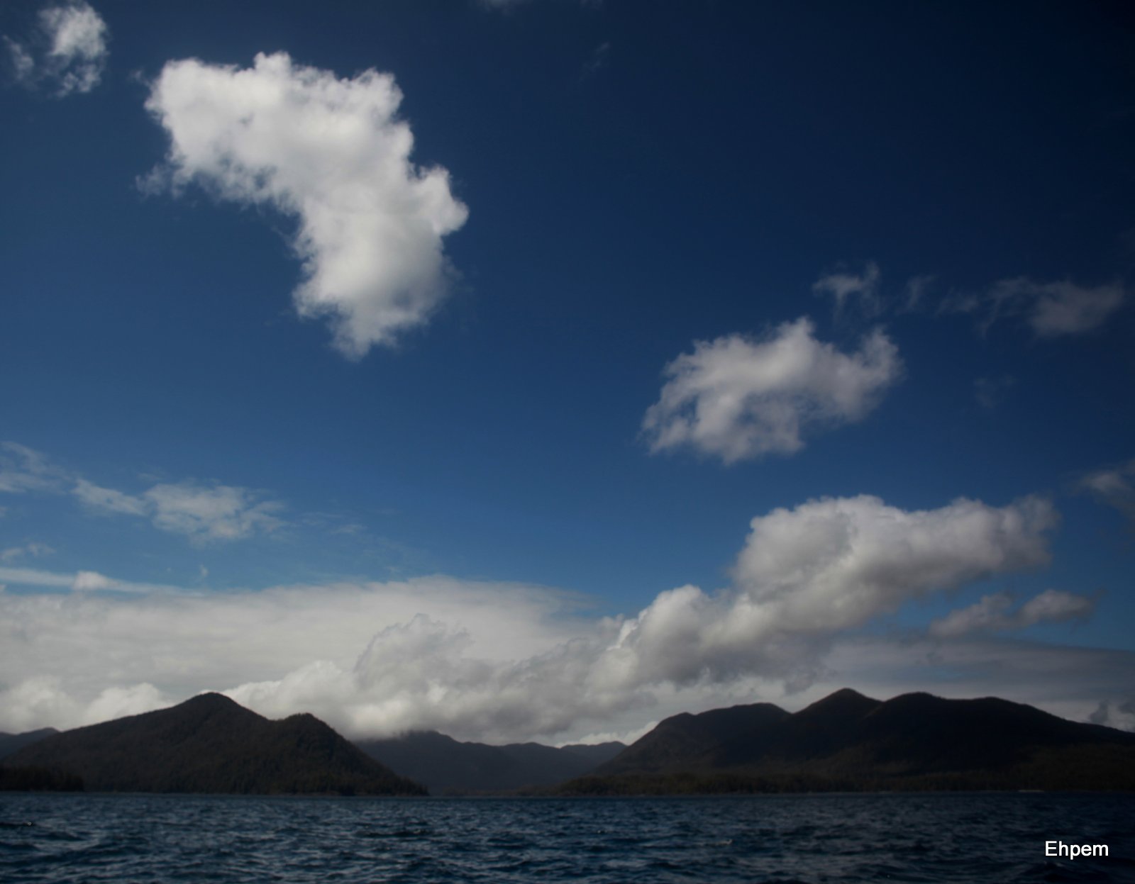
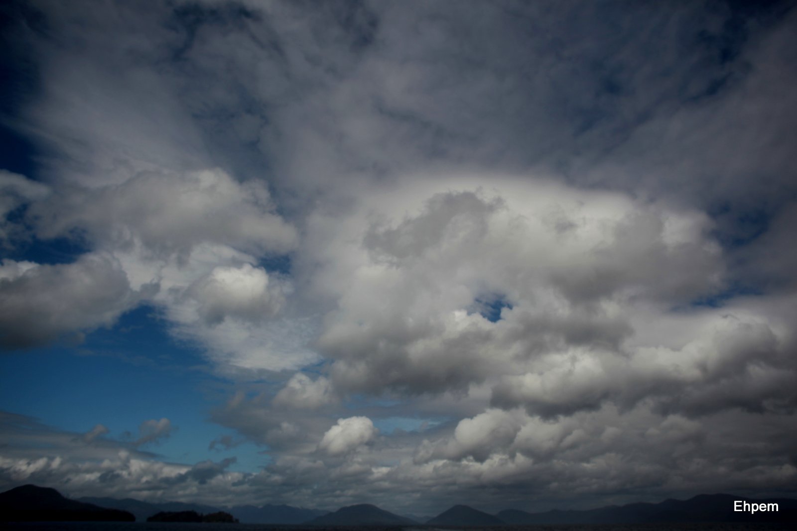
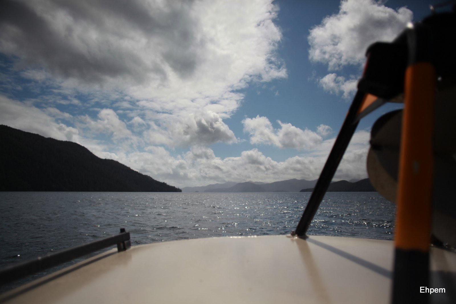
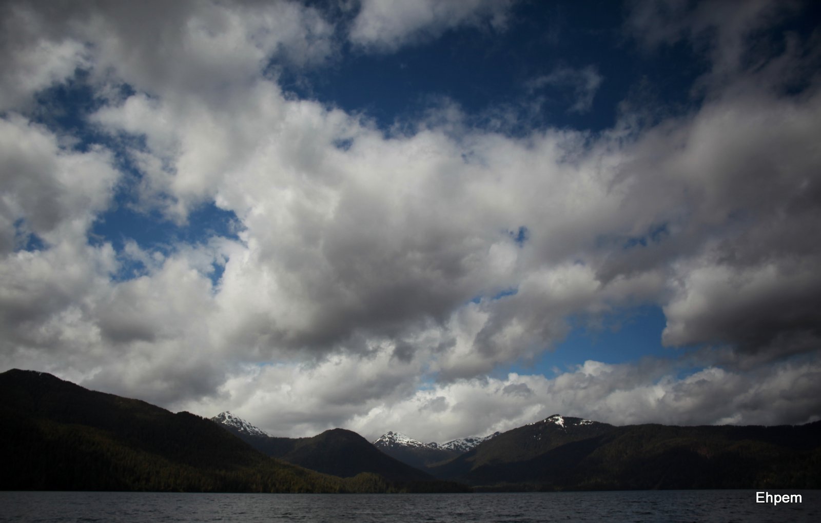
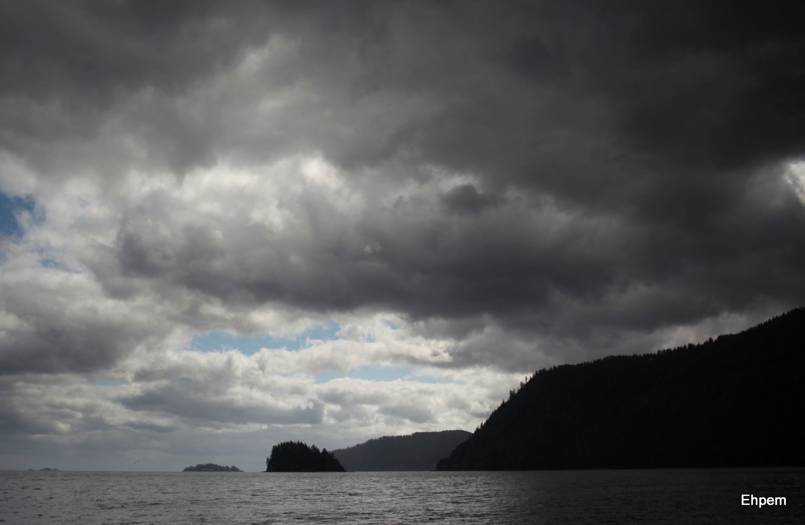
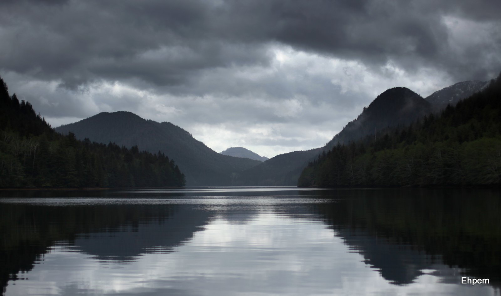
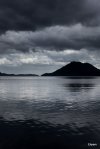
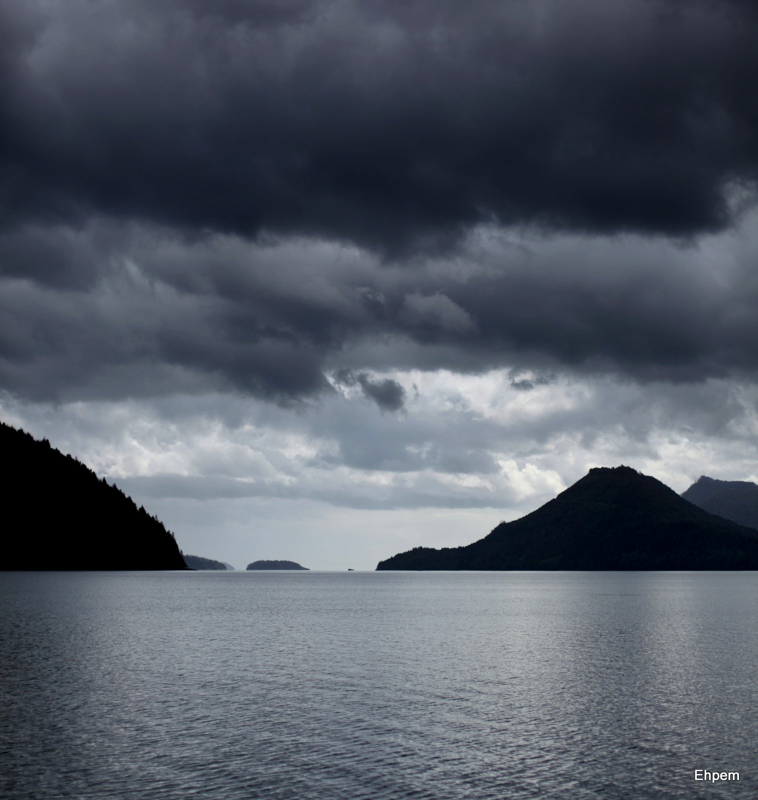
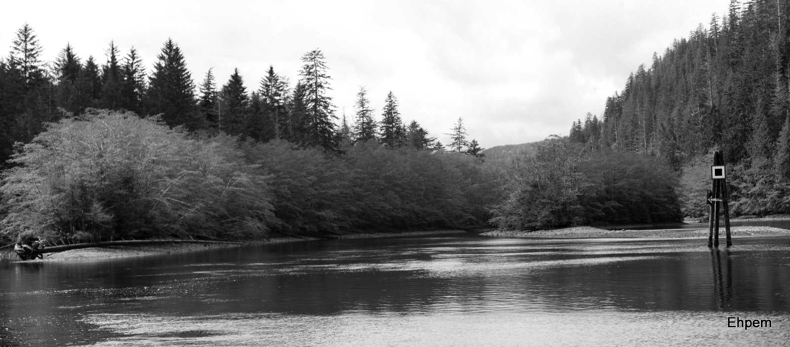
Good maps of this area seem hard to come by – Google Maps is pretty well useless as it has almost no place names. On this web page there is a link to a pdf of a map that includes many of the place names I mention. From Moresby Camp we ran out through Cumshewa Inlet, through the narrows between Louise Island and Moresby Island and south to the Tangil Peninsula which is the northern boundary of Gwaii Haanas park. From there we briefly ventured into Hecate Strait north of Tanu, crossing into the park and then west to Darwin Sound, south to and through Juan Perez Sound and on through the narrows between Burnaby Island and Moresby Island. Today’s photographs take us that far, but we then continued along into Skincuttle Inlet, back out into Hecate Strait to get us beyond the rough water at Benjamin Point and then west into Houston Stewart Channel which runs along the south end of Moresby Island and the north side of Kunghit Island. Our camp was on Ellen Island in the middle of the channel across from Rose Harbour, a former whaling station. I know, too much information for all except those that have been here before, but these are places very familiar to me from previous visits, and so they are part of my personal geography that I feel like sharing 🙂
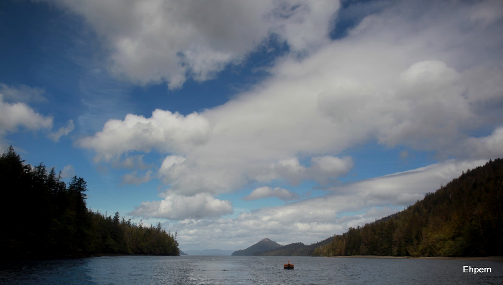
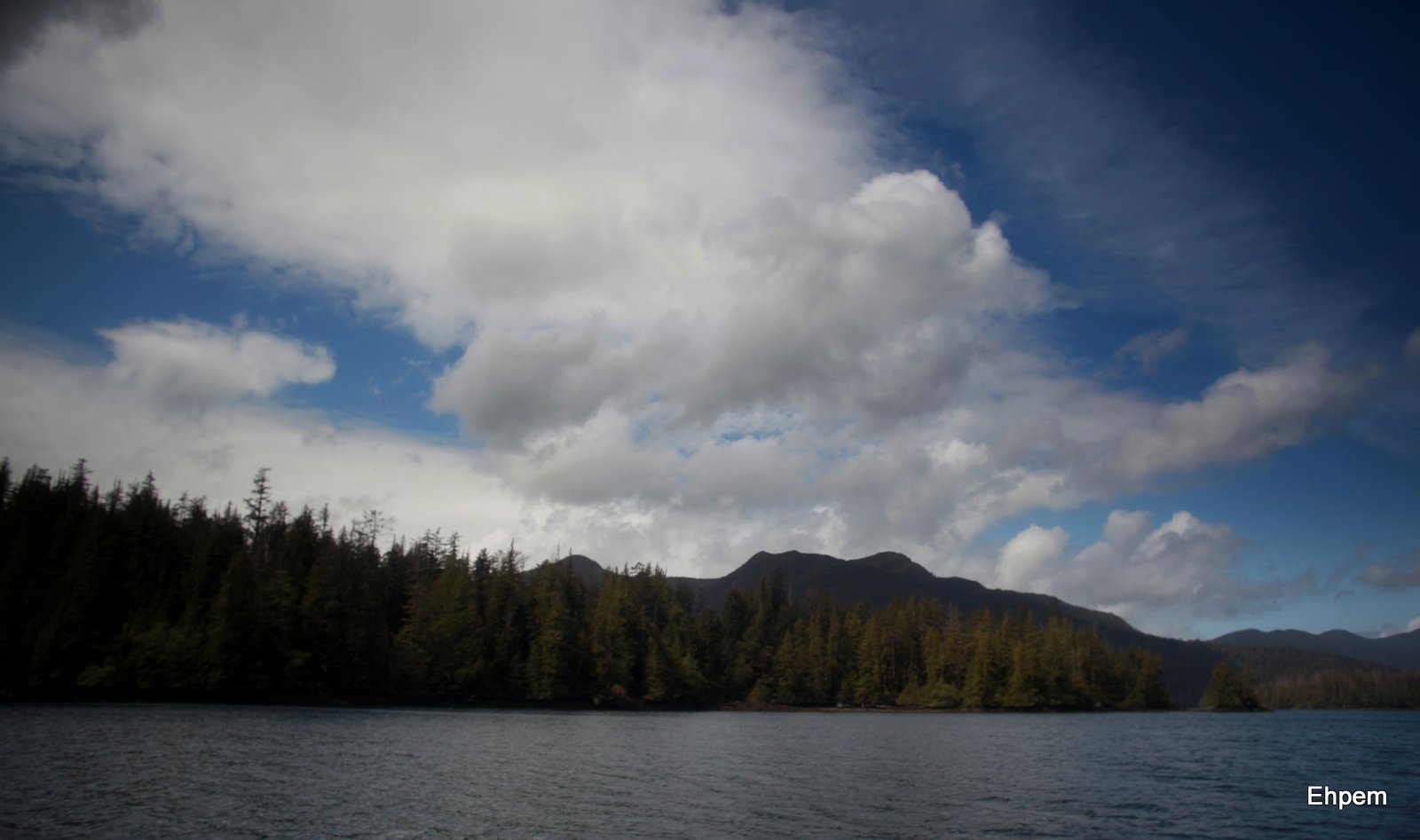
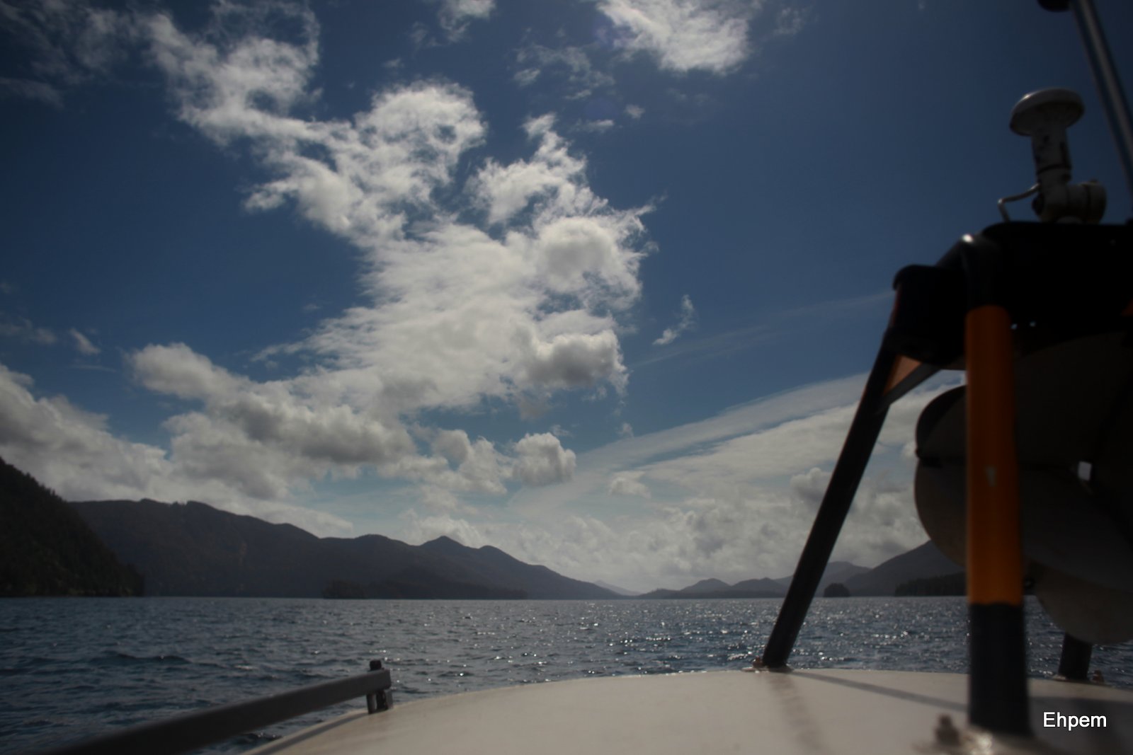
The gallery below shows the skies that caught my attention between Moresby Camp and Burnaby Narrows (that is what I have always called it, but the map says Dolomite Narrows). It was not all that easy taking photos along the way – the boat moves along at about 25-30 mph and is in constant unpredictable motion from the chop and swell. I stopped taking photos at Burnaby Narrows as it is extremely shallow and my eyes were needed for navigation. After that the water surface became much busier and spray was coming over the cabin roof where I would brace myself with the camera. I try very hard to keep saltwater off the camera, so after wiping it down from one rambunctious wave, the camera was put away for the rest of the trip.
To launch the gallery view click on any photo, use the arrows to navigate between images and press escape to return to this page.
-

- N entrance to Burnaby Narrows

-

- N from Dolomite (or Burnaby) Narrows, Huxley Island in distance
-

- Dolomite Point on the NW corner of Burnaby Narrows
-

- West of Huxley Island looking at Burnaby Narrows in distance
-

- Newberry Point opposite Huxley Island in S Juan Perez Sound

-

- Juan Perez Sound looking at entrances to Hutton and Marshall Inlets
-

- Juan Perez Sound, looking NW towards De La Beche Inlet
-

- South Darwin Sound, Lyell Island to left
-

- Klunkwoi Bay, north Darwin Sound, Moresby Island snow
-

- Logan Inlet, looking E at Flower Pot Island, with Tanu Island on right. In Gwaii Haanas at last.
-

- Dana Passage with Talunkwan Island to left and Gwaii Haanas in distance
-
- Looking east out Selwyn Inlet and at Talunkwan Island

-

- Looking east out of Selwyn Inlet, Talunkwan Island to right

-

- Looking east out of Selwyn Inlet
-

- Alders in Louise Narrows, a dredged channel between Louise and Moresby Islands
-
- Troller in Cumshewa Inlet

-

- Falcon along the road to Moresby Camp
-

- From Moresby Camp out Cumshewa Inlet
-

- Skidegate – breakfast sky
By-the-way: I was accompanied on this trip by Tansy, one of the Quimper Hittys, who is presenting a parallel series of blogs about the trip from a doll’s eye view. You can find those posts here.
Canon 5Dii, Canon 50mm/f1.4 lens as far as Dana Passage and then a Nikkor-N 24mm/f2.8 lens the rest of the way south, except the falcon photo was taken with a 200mm/f4 SMC Takumar lens. ISO mostly 100, but up to 640 in earlier and darker stages of the trip.
.
.


Pingback: Museum Edits « burnt embers
Fantastic photos. LOved them 🙂
LikeLike
Thank you!
LikeLike
We were just at the Craigflower Schoolhouse with the TLC the other day and found an archeological pit that had previously been worked on. If I recall, they said they found evidence of civilization from over 3,000 years ago. This made us stop in our tracks to ponder what this really means in the big picture. Considering this as a contrast for the project you’re working on here, I am amazed at mankind and our rich and long standing history in this area. I cannot wait to see what comes from your adventure here!
LikeLike
Funny small world, this archaeological one. Much of the Craigflower work was led by Quentin Mackie, mentioned later in this series and present on the Kilgii Gwaay project too.
LikeLike
I can’t even get my head around that, my friend! A small world, indeed!!!
LikeLike
Some classic seascapes here. Thoroughly enjoyed them
LikeLike
Thanks Andy. Its a beautiful part of the world – I was lucky to have some good clouds on the trip in.
LikeLike
Amazing. These images are beautiful. The sea and sky seem to erupt with light in these shots. Lovely.
LikeLike
I love the size the sky becomes when out in a boat. Even in really overcast conditions, it is still brighter than on shore.
LikeLike
I’ll go out on a limb here and say these are some of the best images you’ve ever posted. The falcon photo is beautiful not only for the bird, but the surrounding background coordinates so well.
I’m eager to hear about the day-to-day activities and also what experience/background is necessary for something like this.
LikeLike
Thanks so much Ken. It is a beautiful and photogenic place. The falcon, I forgot to mention, was chasing a small bird which disappeared in a dense bit of forest which is why the falcon came to rest.
I will be able to present some of the background activities, but the project leaders and student are still in the bush on the next phase, not due to get back on the grid for another month, and I need their permission for some things, like using pictures of them and some of the findings.
In terms of experience – there was a typical mix for this project, which has been running in one form or another for more than 20 years. Experienced archaeologists leading or volunteering, graduate student(s) with specific research in mind, and Haida archaeologists or trainees. We share the various duties according to experience and capability, including things like cooking. In my case, and in a former life before I became bound to a mortgage and strapped into a cubicle, I was a field archaeologist. I have some Haida Gwaii experience starting in the 80’s and I have worked on quite a number of waterlogged or wetland sites in the NW and in the UK, which is a specialized type of digging that was needed on this project. Also, I know the project leaders very well. Hence my involvement. Lucky me, eh? 🙂
This project has constraints on the numbers that can be involved – park policy does not allow large groups, and the size of boat and accommodation place logistical limits – so it is normally between 6 and 8 people. However, there are other projects in BC, often in pretty remote areas, where it can be possible to volunteer. For inexperienced people, it is usually required that they put in enough weeks (usually 2 or 3) that they learn enough to be productive and are not a net drain on project resources. It can be pretty tricky to make these arrangements, and research projects really are the best bet. Most archaeology is done for consulting purposes, to ameliorate the damage from development, and they often have worries about liability, logistics and so on.
LikeLike
Thanks for this photojournal of the Queen Charlotte Islands. It was always a dream of mine to sail up the coast and cross over one summer, but it should’ve been done in my younger days :). Glad you got some nice breaks in the weather. Looking forward to the updates on the dig sites.
LikeLike
Hi David, there are some very nice smallish tour vessels that one can sail/motor up there on. Not the same as doing it oneself, and expensive, but it is an option. We were visited at the site by a spritely ~85 year old who clambered out of the zodiac with only a bit of help and asked the best questions of any visitor we had. We had a surprising number – 10 or 15 in two weeks. Probably because Rose Harbour is a stopping point for people – some stay there (it is the only private property in Gwaii Haanas) and others anchor on their way to and from SGang Gwaay, the nearby world heritage site (also known as Ninstints, on Anthony Island).
LikeLike
What will you be doing at the archaeological site? Digging, cleaning, cataloguing, making the snacks? You must be thrilled to be there. I know I would be – even if making the snacks was my job.
LikeLike
All of the above, and photography 🙂
LikeLike
Marvellous images, again!
LikeLike
Thanks Katherine, again 🙂
LikeLike