
Setting up Kilgii Gwaay

Today’s post sets up the next few posts about volunteering at the Kilgii Gwaay archaeological site with some background about the site. It also shows some of how we set up a site for excavations in the unusual conditions that prevail here. I think the rest of my posts will be much less wordy and reference readers back to this one for information. I have to go back to work this week, and writing time is going to be in short supply.
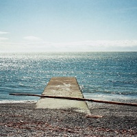
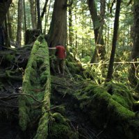
Our arrival at Kilgii Gwaay was in the early afternoon with many hours of daylight left. However, since it was at higher tide we could not start to set up the site for our work, other than moving gear to the site area. Tides matter because the site is in the intertidal zone and work must be done when the tide is out. Indeed, the dates for this project were chosen to coincide with some of the lowest tides of the year. Working with the tides creates all kind of logistical hassles and often means working at night, or in the wee hours of the morning. In previous years the low tides have sometimes been in the middle of the night and we worked with halogen lights for an hour or two before dawn. This year we faced 4am starts slowly moving to 8am during the two weeks. At first we arrived at the site at or near low tide, but later we could arrive on a falling tide and get more hours of excavation.![]()
Kilgii Gwaay has been excavated before. It was discovered by Haida archaeologist Captain Gold in the 1990’s who found stone artifacts lying on the beach. Such sites are not uncommon, though usually they are represented by just a few tools. It is known from various studies in Gwaii Haanas over the past two decades that these sites date to 10,700 years ago when sea level was just a bit lower than now (if you read elsewhere that it was 9,400 years, that is in radiocarbon years which need correction in this early period – I am using a calibrated date in calendar years). These sites are the remains of places that people were camping or working on upland areas immediately next to the shoreline as it was then. The types of stone tools are not found in the more recent sites that are on modern shorelines, in fact almost no stone tools are found in these sites whose occupants relied on other materials such as bone, shell and wood for their tools. It has also been noted that the intertidal site types almost never occur on beaches in front of sites that date from the past 2000 years or so. Thus, when a site like this is found in Gwaii Haanas, archaeologists are reasonably confident that it dates to this early time period. At Kilgii Gwaay this age has been confirmed with numerous radiocarbon dates sampled from artifacts and associated materials.
Typically these intertidal sites are part of a lag deposit left when the sea level rose over the campsites and washed all the fine sediments out. In this area sea level rose because the land was falling in reaction to the melting of heavy glaciers on the mainland which had lifted the part of the crust off shore on which Haida Gwaii sits, rather like you (an analogue glacier) sitting on the corner of a water bed and forcing the surface up on the other side. Sea levels rose to 15m higher than modern levels within about 200 years of these occupations (yes, it was coming up quickly) where it stayed until ~5500 years ago. After that the land levels started to rise (relative sea level thus started to fall) due to tectonic uplift, a trend that continues today. So, until recently all these sites were sub-tidal, and for about 5,000 years they were on the sea floor 15m (50 feet) down. One does not expect much archaeological evidence to survive such conditions, and at most sites that has proved true with only a few stone tools providing evidence for past use of the area. However, Kilgii Gwaay has some intact deposits surviving, and due to being sealed from oxygen, has preservation of organic materials such as wood, bone and shell as well as the stone artifacts. Wet or waterlogged sites with this kind of preservation are very rare in any time period. One this old (it is one of the oldest sites known on the Northwest Coast) is unprecedented and thus the site is of the highest significance possible – I have heard it said that this site is one of the 5 most significant in the northwest.
The discovery of Kilgii Gwaay and realisation of its significance is the culmination of many years of incremental study done in Gwaii Haanas to understand the paleoenvironment, the sea level history and other variables important to finding and understanding ancient archaeological sites in the coastal areas. These studies have been conducted by a multidisciplinary team of scientists led by Parks Canada archaeologist Daryl Fedje. You can read more about this work in an excellent scholarly book published in 2005 that is one of the many published outcomes of work conducted over the past 20 or 25 years. The book is called Haida Gwaii: Human History And Environment from the Time of Loon to the Time of the Iron People and is edited by Fedje and Rolf W. Mathewes.
It was my good fortune to be volunteering on this project with Daryl, a Parks Canada archaeologist (and to have been intermittently involved with his other work since 1992). Also present on the project is another contributor to the book, University of Victoria archaeology prof Quentin Mackie. Quentin is the author of a terrific blog about Northwest Coast archaeology (the blog recently won a communications award from the Canadian Archaeological Association). He has worked in Gwaii Haanas for many years and his blog features several posts on earlier work done on Kilgii Gwaay and related excavations in Gwaii Haanas which can be found here and here and here. If you are interested, these are the most accessible places to find out more about the larger project, as well as Kilgii Gwaay in particular. If you are videocentric, then you might be interested in getting information from the two videos embedded below which are talks given by Daryl and former Parks archaeologist Nicole Smith (who also was present this year for just a few days, passing through as part of another project she is working on in Gwaii Haanas). And, if you want to dip into other videos in that series that discuss aspects of Gwaii Haanas culture and history, check out this link.
After the site was discovered by Captain Gold it was first tested in 2000 as part of an environmental impact assessment associated with a proposed boat fuelling station that was to be placed on a nearby headland;. Those tests found what appeared to be intact layers below the beach surface. In 2001 excavations took place to more fully assess the deposits and then again in 2002, the year I first volunteered at this site. The results of these early studies showed that in the middle of the beach there was a small pond and it was on the east and west sides of the pond that people were living, immediately next to the marine edge. The pond has a paleoenvironmental record in the form of pollen, diatoms and other microfossils as well as larger plant remains that goes back 13 or 14,000 years and provides a lot of information about the nature of the plant communities at this location when it was occupied, and the history of inundation of the pond by rising salt water levels. At the time of occupation the channel in front of the site would have been much shallower and probably very rich with intertidal species.
Kilgii Gwaay was found to contain a lot of animal bone and some shell that showed that people were living from the ocean, including fishing for deep dwelling fish such as halibut, were active well offshore to catch albatross and other birds, hunted sea mammals such as sea-lion and seal and also emphasized bear hunting. Artifacts included wood wedges for splitting wood, wood chips from chopping and whittling, a stick that was repaired or joined with the use of split spruce roots, a piece of very fine three strand braided cordage with 2 strands from split root and one from a grass. The remarkable thing about the wood tools was that not a single one of them, or the group as a whole, would look out of place in any known wet site from any time period indicating a well-developed technology similar to that practiced at the time of contact 250 years ago. Also found were some bone tools and many stone tools like the ones observed on the surface. A remarkable assemblage from a remarkable site.
Ten years ago it was thought that enough had been learned and that it was best to leave the remainder of the site intact for future researchers. However, in the past two years additional visits gave disturbing indications that the site was eroding off the surface much more rapidly than previously understood, and worse, that marine organisms, especially clams, were penetrating into the intact deposits, turning them over and introducing oxygen. This in turn was causing the wood and other preserved organics to disappear almost immediately – some of the more productive areas of the site a decade ago were found to have no wood preservation. Thus, it was felt that an emergency was developing at the site and so this year’s excavations were planned, with extensive preparations made during the 2011 visit. These included coring various parts of the site followed by some limited testing in a few areas to identify places that should be excavated further and the site surface was re-mapped with a laser survey instrument to document its changing condition.

A stone tool, freshly eroded from the surface of the site.
.
This brings us back to our arrival at the site, justifiably worried that we might not find much but stone tools, but also wildly and I think typically of any archaeologist, hopeful of fantastic finds – a basket or part of a boat or paddle or a piece of wood art were all imagined and joked about. As is so often the case we landed in the middle of these extremes, with modest but cumulatively informative finds that will broaden the understanding of this location and of the time period once analysis is complete. But that is getting towards the end of this narrative and is for another day.
First, we had to prepare the site for work. This involved a series of actions such as examining the surface of the site for recently exposed evidence that might contradict our understanding of the site; checking up on the rate of surface erosion; relocating the corner pins from the ten year old excavations units and from them reestablishing the site grid; setting up an area for screening the dirt; establishing a water supply to pump from so we could wash the dirt in the screens and if necessary use hydraulic methods to assist with excavation; covering an area to store gear; and generally to discuss strategies and then to turn those ideas upside down and go at it from a different perspective (an ongoing process as the end of each unit was reached and new ones planned).
Once we had reestablished the grid and decided where to place the new units, they were laid out on the beach surface. The surface, as you will see in many shots over the next few days, is littered with large boulders and these need to be cleared off the excavation units, which often requires strong and willing backs. This is one reason why it is good to have young people involved with the project! And this year we had two excellent Haida trainees, Goox (rhymes with books) and Gwaliga, who not only pressed their strong bodies into service, but brought lively, inquisitive and wonderfully positive intellects to bear on all that we did. It was both a pleasure and highly stimulating to work with them. Since I was able to ask both during their break whether they minded their photographs showing up in this blog (and since both said yes) they will be seen in the next few posts.
The project also included a U-Vic graduate student Jenny Cohen who will be doing an MA on parts of this project and Dale Croes, a Washington State archaeologist and wet site and basketry specialist with more than 40 years of experience – he was invited along to bring his unique experience to the project. As mentioned Nicole dropped in for a couple of days, and also a parks cultural resources employee visited for a day or two. My invitation to the project was, I think, on the basis of experience with these sites before I was shackled to a desk along with a history of volunteering on the project for more than 15 years, as well as quite a lot of wet site experience in three countries. I also was asked if I would bring my camera. Daryl, Quentin and Jenny are still in the field, taking their ‘breaks’ off grid and so I can’t ask permission to use their likenesses in this blog, but you will probably become familiar with their boots, legs, arms and backs! Why I did not ask before leaving camp, I can only explain by having a very poorly formed idea of what I might blog about and which images I might use – I had intended to make it more about the scenery and less about the work, but comments on my initial posts indicate I had better get some archaeology into this series as well.
 These two stone tools are as found and have eroded from the site since last year. They show that at least 5cm of sediment is gone from this location.
.

GPS is used to check previous survey results and plot this years changes.
.

Units are laid out as the tide retreats to maximize the time for excavation.
.

A new unit is checked for precision of layout.
.

A 2012 excavation unit all ready to go in the foreground – it is next to units from 10 years ago that have been mapped out on the beach surface as well. The string goes around triangles of pins at the corner of the excavation units – this is an unusual layout necessitated by the extremely loose and wet sediments near the surface which are prone to slumping. Typically the corner pins fall into the unit within a few hours of starting work, but the outer nails continue to hold the string and maintain an accurate guide to excavation.

Goox clearing a boulder from the edge of a new unit to ensure it does not slump in and hurt someone.
.
This link catalogues my posts on the project. I was accompanied on this trip by Tansy, one of the Quimper Hittys, who is blogging about the trip from a doll’s view. You can find those posts here.
Canon 5Dii, Canon 50mm/f1.4 lens at ISO 640 except third last which used Nikkor-N 24mm/f2.8 lens and ISO1250. Today the photos have all been de-saturated as to do so suits my mood and the rainy setting.
.
.


Pingback: Kilgii Gwaay Finds « burnt embers
Pingback: Water Screen « burnt embers
Your photos are wonderful. The project looks amazing. I can’t wait to read more about your time at the site.
LikeLike
Thanks Ryan – there are a few more posts to come, including some about the surrounding area that are not strictly archaeological, but more touristy.
LikeLike
I read and reread this piece several times in an effort to fully absorb the enormity of what you have found and are working on there. Wow!! What a great opportunity, and I am so thankful for your photography that really brings this story to life for everyone here to enjoy!!
LikeLike
Oh dear, I hope it was not too difficult to read. I find it can be hard to write the technical stuff for a wider audience. I will illustrate some of what I said in upcoming posts, and Tansy Hitty has been doing it in her own way too.
Enormity is a good word for the work at this site over the years. While there is not much recovered in absolute numbers (maybe 200 wooden artifacts and associated debris like wood chips, perhaps 10 bone artifacts, several thousand stone artifacts and 4000 or so animal bones as refuse from food and other uses – this is compared to some sites that have 10’s of thousands of things) the importance and contribution it makes to understanding the earliest maritime cultural adaptions in the Americas is much larger than the size of the collections.
LikeLike
I thought it read perfectly fine! There was a lot of information to take in, but it was all well written as we are used to from you, and it was CAPTIVATING! Of course we knew that civilization was old around these parts, but now we have some great context for that thought! Love your work, my friend, absolutely incredible.
LikeLike
Thanks so much 🙂 It has been a privilege to be involved with these discoveries and to learn from some of the best practitioners that exist.
LikeLike
This is a well documented report of your two week adventure. I’m glad you were able to participate in what appears to be a worthwhile project.
LikeLike
Hi Ken – thanks! It is indeed a worthwhile project. I do have some good pictures from the trip, but most of them are not of the archaeology but of the area when I could get a chance to get out and about (rarely).
LikeLike