Flower Pot Island
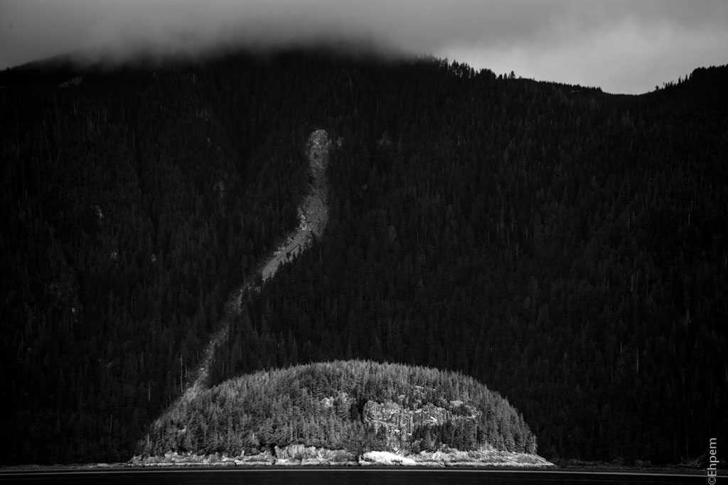
Flower Pot Island seen from the Passing Cloud off shore from Titul Island.
In the back ground is the Tangil Peninsula, the spine of which is the northern Gwaii Haanas boundary.
Flower Pot Island seen from the Passing Cloud off shore from Titul Island.
In the back ground is the Tangil Peninsula, the spine of which is the northern Gwaii Haanas boundary.


| ♦ FUJITA (藤田光学工業) H.… on Fujitar P.C 35mm F2.5 Asahifle… | |
| ehpem on Child’s Grave | |
| Kyle Hoyt on Child’s Grave | |
| ehpem on Charles Elliott Pole, Universi… | |
| Lisa Kadonaga on Charles Elliott Pole, Universi… |

Flower Pot Island 🙂 Are you making these names up?
LikeLiked by 1 person
what is the story behind that name??
LikeLike
Hi Sherry, I don’t know the origin of the name, but suspect that it looks like a flower pot from some angles. There is another one at the northwest end of Haida Gwaii.
The island was called Tsiiskay in Haida, and had on top the place called Qqaaxhada Ttaawji or Dogfish Fort. I am not sure of the current orthography for these Haida names. Alternate spellings include ts’isgi gwaayaay (gwaayay/gwaay/gwaii means island) and q’axada t’awts’is (t’awts’is/ttaawji/taodji means fort). One document I looked at says that ts’isgi might be related to the word for a pot or box float, so perhaps this sheds some light on the name as well.
LikeLike
Not making any names up! Interesting thing about names in this area is that many were given (superimposed on Haida names) by George Dawson of the Geological Survey of Canada in the late 1800s. He named them after scientists, mostly geologists, so there are a lot of names familiar to students of British science history like Lyell, Huxley, Richardson, Darwin, Matheson, Murchison, Faraday, Ramsay, Beresford, Bigsby etc
LikeLike