
Narrows II
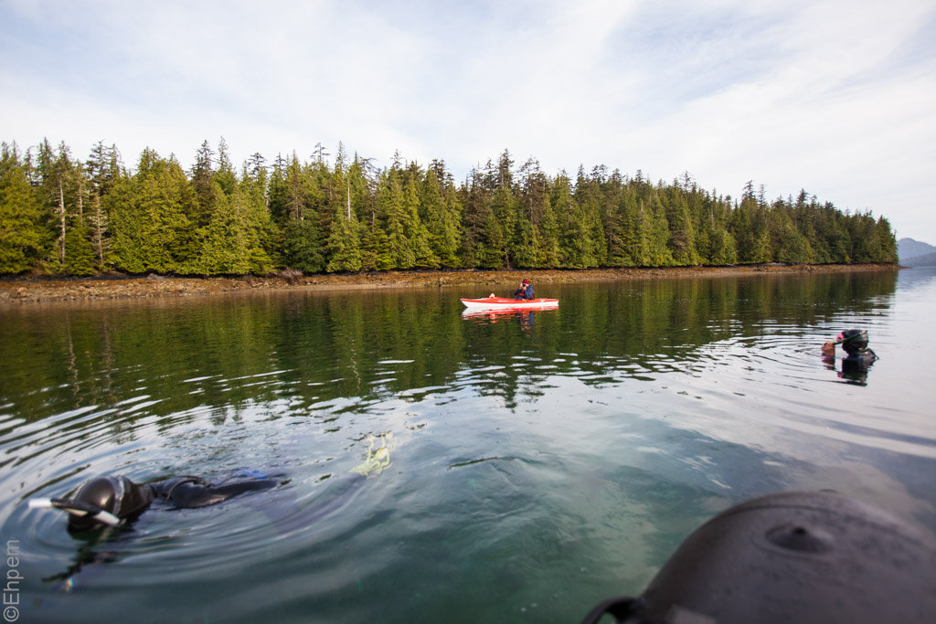
On my trip aboard the Passing Cloud we visited Burnaby Narrows (Dolomite Narrows on the chart) a couple of times.
It is on the west side of Burnaby Island in Gwaii Haanas, Haida Gwaii.
The narrows have a fantastic concentration of intertidal and subtidal life, encouraged by the high water flows with concentrated nutrients.
There is so much life living on the ocean floor that it is not possible to walk on the beaches at low tide.
The best way to see the cornucopia is to bring examples to the boat to look at and then return them to their homes.
Kayaks with windows in the floor are another good way – the Passing Cloud carries two of these , one of which is seen here.
On the Passing Cloud the first mate was responsible for retrieving specimens for the passengers in the zodiac to look at.
On one trip a passenger had brought her wet suit and joined him.
(more…)
Steller III
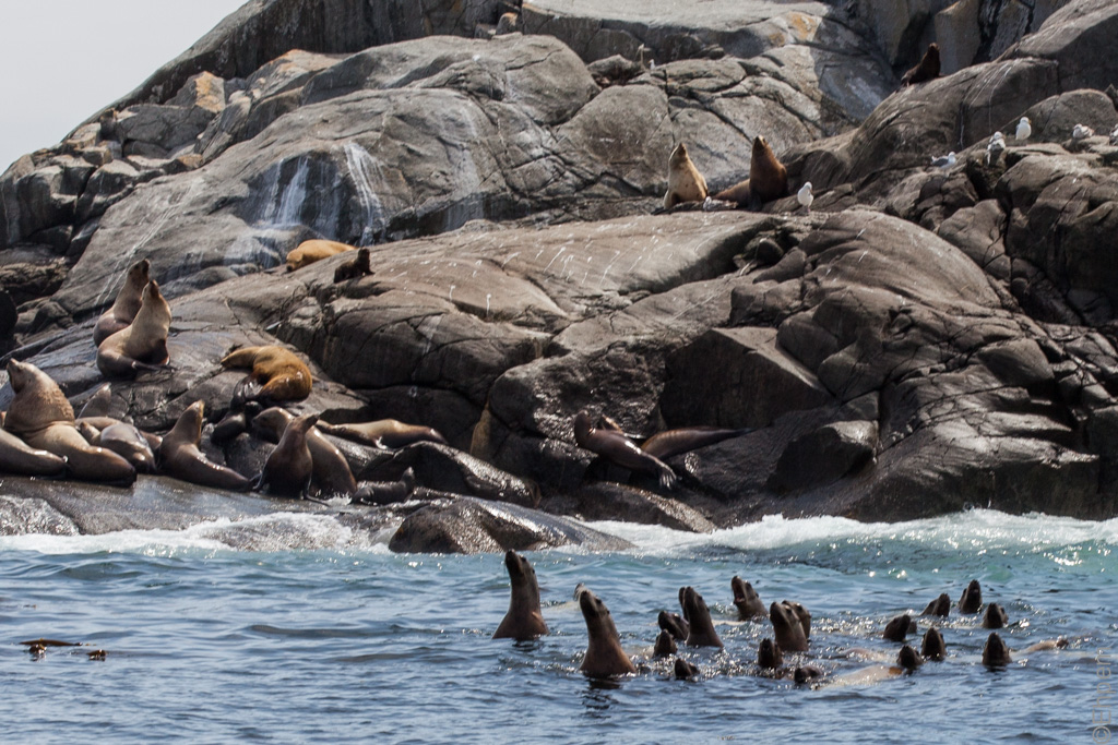
Further to my posts Steller and Steller II this is a crowd of youngish Steller Sea Lions checking us out while approaching on the Passing Cloud’s dinghy.
Seen at the Garcin Rocks rookery/haulout east of Benjamin Point near the south end of Moresby Island.
If you want to see this location in Google’s “street view” mode, try clicking on this link.
(more…)
Windy Bay Creek
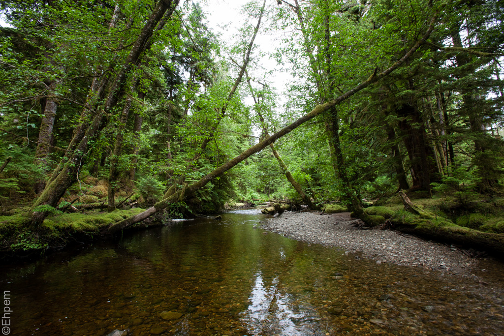
While on the Passing Cloud we visited Windy Bay on Lyell Island a couple of times.
There are Haida Watchmen at Windy Bay, with a recently carved pole that was raised to commemorate the founding of Gwaii Haanas.
There is a very nice walk through the forest which passes beside some very large spruce and cedar trees.
Along the path one has to cross this creek.
Preparing this post I discovered that in its own extraordinary way, Google Maps has a street view along this path!.
If you go to this link then click on the street view button (little yellow person icon in lower right of screen) it will show the path.
And if you drag the icon and drop it on the path then you can follow the path as if you are on a downtown street.
Which is pretty darned cool. And there are lots of street views in Gwaii Haanas now.
When I was working in Gwaii Haanas last year I heard that Google had been up that summer doing this project with Parks Canada – its nice to see it up and running.
Tufted II

A Tufted Puffin in southern Haida Gwaii from aboard the schooner Passing Cloud.
We saw a lot of tufted puffins along the southeast shore of Kunghit Island.
Another puffin picture can be seen at my earlier post Tufted.
(more…)
SGang Gwaay III

A path that leads to a viewing area at the back of the Kunghit Haida Chief Ninstints’ house at SGang Gwaay.
The wood on the left sticking out of the spruce tree is one of the rear corner posts of the house.
The spruce nursed on the top of the post and then grew around and through the post splitting it apart, ejecting some and swallowing the rest.
The small structure is a shelter for visitors that is adapted from the design for a small Haida house, or a large grave house.
I was visiting while on a tour of Gwaii Haanas aboard the Passing Cloud.
If you want to know more about SGang Gwaay I have written about it in several posts (link) from previous visits.
(more…)
Houston Stewart Channel III

From an anchorage while aboard the schooner Passing Cloud near the east end of Houston Stewart Channel at Rose Harbour.
T
(more…)
Anna Inlet III

A third view from the Passing Cloud while in the Anna Inlet anchorage, Moresby Island, Gwaii Haanas.
My first view of this location, looking in the opposite direction, can be seen at Anna Inlet, and the second at Anna Inlet II.
(more…)
Top Posts & Pages – Click Thumbnail To View


Recent Comments
♦ FUJITA (藤田光学工業) H.… on Fujitar P.C 35mm F2.5 Asahifle… ehpem on Child’s Grave Kyle Hoyt on Child’s Grave ehpem on Charles Elliott Pole, Universi… Lisa Kadonaga on Charles Elliott Pole, Universi…
